Highway 50 across Nevada is called “The Loneliest Road in America,” apparently due to the desolate landscape through which it passes. We did indeed encounter only a few other travelers along this five-hour drive. The landscape was arid, open, and unpopulated except in the few small towns along the way. There were, nevertheless, many traces of historic mining and ranching activity. The road also crosses the old Pony Express route in a couple places.

Along highway 50. Photo by Sarah.

Ruins of New Pass Station, west of Austin, Nevada. This was a stagecoach stop in the 1860s, but it fell into disuse after completion of the transcontinental railroad. As with many of the frontier settlements here, it was situated near a natural spring. Photo by Blake.

Pony Express station, Cold Spring, Nevada. This was an interpretive structure near the original site. The picture gives a good idea of the harsh landscapes that Pony Express riders had to endure in the nineteenth century. The route extended about 1900 miles from St. Joseph, Missouri to Sacramento, California. Photo by Blake.

Rock text near Fallon, Nevada. Fallon is one of two places on this trip through which we passed on our 1991 trip from Houston, Texas to Portland, Oregon. The other intersection was Las Vegas, but that’s a blog post for another day. Photo by Sarah.

This day’s long drive across the dry interior of Nevada was rewarded as we passed through Carson City, up over a mountain pass, and dropped down to Lake Tahoe. We stayed in South Lake Tahoe, where we could walk down to the lake in one direction and to a brewpub in the other. Fantastic! Photo by Sarah.

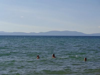
Kenny and Sam could have happily stayed here for the entire trip. Photo by Blake.

Sarah. Photo by Blake.
Hey Sarah & Blake, i'm enjoying the journey, your journey, i'm post op at the mo, so loving the pics more so, keep well, :)
ReplyDeleteGreat picture of Sarah !
ReplyDelete